East Africa Travel Planning and Regional StrategyWhy East Africa Travels Differently Than Most Regions
East Africa is often marketed as a single, seamless safari circuit. In practice, it is one of the most structurally fragmented travel regions in the world. The countries commonly grouped under “East Africa” share ecological systems and historical ties, but they do not share the same level of infrastructure maturity, administrative efficiency, or transport integration.
What differentiates East Africa at a regional level is that access reliability, not distance, governs travel behavior. A 300-kilometer transfer here can consume more time and energy than a 700-kilometer transfer in a highly integrated region. Road quality varies dramatically, domestic flight networks are thin outside of major hubs, and weather sensitivity is high in rural and protected areas.
This creates a planning environment where time buffers are not optional and where itinerary ambition must be matched to infrastructure reality. Travelers who design East Africa routes as if it were a compact, high-connectivity region often encounter cascading delays: late arrivals, missed onward transport, forced overnight stops, and compressed experience days.
The deeper issue is that East Africa does not behave like a tourism network — it behaves like a development gradient. Some corridors function reliably and predictably. Others function only under favorable conditions. Planning success depends on recognizing which is which.
The practical implication is that East Africa rewards depth over breadth. Fewer countries, fewer long transfers, and stronger base locations consistently produce better outcomes than aggressive multi-country circuits.
💡Quick Facts:
Continent: Africa
Country: Burundi, Comoros, Djibouti, Eritrea, Ethiopia, Kenya, Rwanda, Somalia, South Sudan, Tanzania, Uganda
Administrative Division: Eastern Africa (UN geoscheme)
Capital: N/A (multi-state region)
Largest City: Addis Ababa (Ethiopia)
Area: ~6,100,000 km² (~2,355,000 mi²)
Population: ~480 million
Density: ~79/km²
Regions/Subregions: Horn of Africa, Great Lakes, Swahili Coast, Ethiopian Highlands
Official Language: Multiple; Swahili and English widely used regionally
Currency: Multiple national currencies (varies by country)
Time Zone(s): EAT (UTC+3)
Religion: Christianity and Islam dominant regionally
Known For: Savannah safaris, Great Rift Valley, Mount Kilimanjaro, Great Lakes, Indian Ocean coast
🛂Arrival Info:
Entry Requirements: Varies by country; passport required for all international arrivals
Customs Allowances: Country-specific
Declaration Forms: Country-specific arrival declarations
Visa Requirement: Country-specific
eVisa Application: Available for several countries via national immigration portals
Visa on Arrival: Available in some countries for select nationalities
Passport Validity: Commonly ≥6 months beyond entry
Onward Travel Proof: Often required
Visitor Access Fees: National park and conservation fees vary by country
Official Source: National immigration authorities of destination country
🏥Health Info:
Vaccination Requirements: Yellow fever certificate required for some cross-border movements
Routine Immunizations: As per international travel standards
Medical Facilities: Best in major cities; limited in rural areas
Healthcare System: Mixed public–private; standards vary widely
Travel Insurance: Commonly required for visa issuance in some states
Emergency Medical Access: Urban ambulance services limited outside capitals
Pharmacy Availability: Widespread in cities; restricted in remote areas
🚑 Check travel insurance options for travel emergencies, delays, and medical needs abroad — Get coverage here
💉 Stay Informed with Official Updates: WHO – International Travel & Health | CDC – Travel health updates
🚨Travel Advisory:
Entry Restrictions: Subject to change by individual governments
Travel Advisories: Issued separately by foreign ministries
Local Authority Notices: Published by national governments
Security Status: Varies significantly by country and region
🌍Track Real-Time Official Updates: US Travel Advisory | UK Foreign Travel Advice | Government of Canada | NZ SafeTravel
💰Visitor Info:
Payments: Cash widely used; mobile money dominant in several countries
Tourist Taxes: Country-specific where applicable
Tax-Free Shopping: Limited availability; country-specific
Average Daily Costs:
Budget: ~US$30–60
Mid-range: ~US$80–150
Luxury: ~US$250+
Accessibility: Limited outside major cities
Service Language: Swahili, English, French, Arabic depending on country
Tourism Authority: National tourism boards of destination country
🛫Airports:
NBO – Nairobi Jomo Kenyatta: Primary regional hub
ADD – Addis Ababa Bole: Ethiopian Airlines’ hub; connections across Africa
DAR – Dar es Salaam / ZNZ – Zanzibar: Coastal Tanzania
KGL – Kigali / EBB – Entebbe: Central Africa access
SEZ – Seychelles / MRU – Mauritius / TNR – Madagascar: Indian Ocean islands
🧳 Delayed or canceled flight? Check if you’re eligible for compensation
🚍Transports:
Public Transport Use: Buses and minibuses dominate
Urban Transport: Minibuses, motorcycle taxis, limited rail
Intercity/Inter-Island Transport: Long-distance buses, regional flights
Driving Side: Left (most countries)
Driving Rules: National licenses accepted short-term; IDP recommended
🚗 Book reliable airport transfers and in-city rides in advance. Reserve your ride here
🛰️Connectivity:
Mobile Networks: Broad 3G/4G coverage in cities
SIM/eSIM Registration: Passport registration required
Roaming: International roaming supported; check carrier agreements
Internet Access: Reliable in urban areas
Public Wi-Fi: Limited; mainly hotels and cafés
Power: 220–240V, 50Hz — Plug Types: C, G
🛜 Stay connected abroad with affordable eSIM data packs. Get your eSIMS here
📜Laws & Etiquette:
Drinking Age: Typically 18 (varies)
Smoking Restrictions: Public-place restrictions common
Alcohol Regulations: Regulated nationally
Drug Laws: Strict; penalties severe
Dress Regulations: Modesty laws in some areas
Photography Restrictions: Government, military sites restricted
Official Source: National legal codes of destination country
👮Safety & Contacts:
Emergency Number: Varies by country (often 112 or 999)
Police Services: National police forces
Tourist Assistance: Limited; embassy support common
English Availability: Common in urban and tourist areas
Official Source: National police or interior ministries
🗺️US/UK Embassies Abroad: US Embassies | UK Embassies
🏛️ Embassy locator tools: Embassies Worldwide
🌞Weather:
Climate Type: Tropical to highland temperate
Average Temperatures: ~18–30 °C (64–86 °F), altitude dependent
Rainfall Seasons: Long rains Mar–May; short rains Oct–Dec (varies)
Humidity: High along coast; moderate inland
High-Risk Seasons: Flooding during peak rains
Flooding Risk: Present in low-lying and riverine areas
Official Source: National meteorological agencies
🌦️ Stay prepared—check the weather forecast for your destination — World Meteorological Organization.
Cross-Border Movement Realities
Borders are one of the most underestimated friction points in East Africa. Unlike regions with highly standardized border regimes, East Africa’s entry requirements, processing speed, and administrative practices differ meaningfully by country and by crossing point.
Several countries participate in the East Africa Tourist Visa (EATV) framework, which allows certain nationalities to travel between Kenya, Uganda, and Rwanda using a single visa, subject to specific conditions. Official government guidance is published by:
This framework reduces paperwork, but it does not remove operational friction. Land borders may still involve manual processing, document verification, currency and customs checks, and variable opening hours. Air borders are generally more predictable, but still subject to staffing levels and peak-period congestion.
It is also critical to understand what the EATV does not cover. It does not apply to all East African countries, and it does not harmonize internal movement rules, vehicle requirements, or domestic transport regulations.
The planning consequence is straightforward:
- Border days must be treated as logistics days, not sightseeing days.
- Same-day cross-border transfers combined with experience-heavy schedules carry high failure risk.
- Travelers with rigid timelines should minimize the number of international crossings.
The cost of underestimating border friction is not only time loss, but also forced spending on accommodation, transport, and rescheduling when plans break.
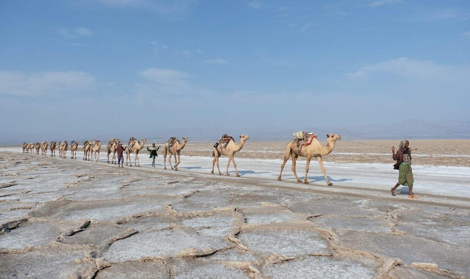
Seasonal Behavior and Environmental Risk Windows
East Africa’s travel conditions are shaped more by rainfall patterns than by temperature extremes. This makes seasonal planning more complex than in temperate regions where “summer” and “winter” provide broad predictability.
Rain affects:
- Road passability in rural and protected areas
- Wildlife movement and visibility
- Domestic flight reliability
- Travel times between parks and regions
National meteorological authorities publish official guidance that should anchor seasonal planning assumptions, such as:
Periods of heavy rainfall can render some routes slow, unreliable, or temporarily impassable. In remote regions, this can mean multi-hour delays, route diversions, or cancellations of scheduled transfers. Some lodges and camps operate seasonally and may close during the wettest months.
The regional planning implication is that East Africa requires season-compatible routing. Attempting to combine wet-season inland travel with tight, experience-dense itineraries significantly increases disruption risk and reduces wildlife viewing quality.
Seasonality also interacts with demand. Drier periods concentrate visitor numbers into narrower windows, which raises costs and reduces flexibility. Wetter periods reduce demand but increase logistical uncertainty. There is no “perfect” season — only tradeoffs between reliability, cost, and experience quality.
Cost Structure and Budget Volatility
East Africa’s cost profile surprises many travelers. While daily living costs in cities can be moderate, the region sits in a high-cost band for experience-based travel, particularly where wildlife access is concerned.
Park fees, conservation charges, mandatory guide or vehicle requirements, and remote-area accommodation costs are fixed structural expenses. They are not easily reduced through “budget travel” tactics.
Official fee frameworks illustrate this clearly:
These fees shape the financial reality of regional travel more than food or urban lodging costs.
The volatility comes from:
- Seasonal pricing in protected areas
- Limited competition on domestic air routes
- High transport costs for remote access
- Peak-period accommodation scarcity
The planning implication is that East Africa is cost-efficient for slow, base-oriented travel, but expensive for rapid, multi-park, multi-country itineraries. Budgets fail most often not because travelers choose luxury, but because they underestimate the structural cost of movement.
Infrastructure Strengths and Operational Gaps
East Africa’s infrastructure story is one of rapid improvement layered over deep structural gaps. Major urban centers — particularly Nairobi, Dar es Salaam, and Kigali — function as relatively strong transport and service hubs. International aviation, medical facilities, and communications are most reliable in and around these cities.
Beyond these cores, infrastructure quality declines quickly. Many high-value travel regions are remote by design: national parks, conservation areas, highland regions, and coastal zones that are distant from primary transport corridors. Road conditions vary from paved highways to unsealed tracks that become slow or impassable after heavy rain. Domestic flight networks exist, but frequencies are limited and cancellations are more disruptive because alternative routes are scarce.
Emergency and medical access outside major cities is uneven. This elevates the consequence of delays, accidents, or health issues during overland travel. For safety and risk assessment, official government travel advisories remain essential planning references. Two consistently maintained sources are:
These portals provide country-specific security, health, and infrastructure context that affects routing and insurance decisions.
The planning implication is that East Africa itineraries should favor reliability over ambition. Fewer regions with stronger access consistently outperform wider coverage with weak transport redundancy.
Cultural and Logistical Transition Zones
East Africa is culturally heterogeneous, and these differences surface operationally. Language use, administrative practice, service norms, and time management expectations vary significantly across and within countries.
Travelers often encounter friction not because of hostility, but because of mismatched assumptions:
- Formal processes are common in government and border interactions.
- Time is often managed more flexibly outside commercial centers.
- Service structures differ between urban hospitality environments and rural tourism operations.
- Documentation and verification are taken seriously, even when procedures appear slow.
These differences affect how much advance planning is required and how much spontaneity is realistic. In some areas, independent travel with minimal structure is feasible. In others, pre-arranged transport, guides, or accommodation logistics dramatically reduce time loss and risk.
The planning implication is that cultural transitions in East Africa require operational adaptation, not just cultural sensitivity. Expecting the same pace, service model, and flexibility across the region is one of the fastest ways to degrade trip quality.
Routing Mistakes That Cost the Most
The most common and costly regional planning errors include:
- Attempting to cover too many countries in one trip.
- Underestimating road travel times and border processing.
- Assuming domestic flights operate with high frequency and redundancy.
- Scheduling experience-intensive days immediately after long transfers.
- Treating protected areas as interchangeable in cost and access.
These mistakes compound. Each additional long transfer increases the probability of disruption and friction spending. Each border crossing adds administrative uncertainty. Each tightly packed day reduces recovery capacity when delays occur.
Effective East Africa routing tends to share several characteristics:
- It anchors the trip in one or two core countries.
- It emphasizes regional depth over geographic breadth.
- It aligns movement with the most reliable transport corridors.
- It protects high-value experience days with buffers.
The planning implication is that itinerary resilience matters more than itinerary density.
Who East Africa Fits Best as a Travel Region
East Africa delivers its strongest value to travelers who:
- Prioritize nature, wildlife, and landscape over urban sightseeing.
- Are comfortable with variable infrastructure and slower travel rhythms.
- Accept higher structural costs for access to remote experiences.
- Are willing to plan logistics in advance rather than improvising.
- Value experience quality over destination count.
It is less suitable for travelers seeking:
- Rapid, multi-country city-hopping.
- High-density cultural touring with minimal transit time.
- Low-cost, highly spontaneous travel.
The region rewards patience and preparation. It penalizes speed and compression.
How East Africa Fits the African Continent
Within Africa, East Africa occupies a distinct position. It is one of the continent’s most accessible regions for international travelers, yet it is not low-friction. Compared to Southern Africa, it often involves higher costs for wildlife access and more variable infrastructure. Compared to North Africa, it involves greater logistical complexity and less transport redundancy.
East Africa functions best as a primary travel focus rather than an add-on. Its value lies in immersive, regionally grounded experiences that require time and structural planning to realize.
The continental planning implication is clear: East Africa should not be treated as a transit corridor. It is a destination system in its own right.
How East Africa Fits Global Travel Flows
East Africa sits at the intersection of several major long-haul travel corridors linking Africa, Europe, the Middle East, and Asia. This positioning makes it one of the continent’s more accessible regions for intercontinental travel, but also exposes it to global capacity shifts and policy changes.
International air access is concentrated through a small number of primary gateways, with Nairobi, Dar es Salaam, and Addis Ababa serving as the most significant network nodes. These hubs connect East Africa to Europe, the Gulf, and parts of Asia with relatively high frequency compared to other African regions. However, onward connectivity within the region remains thin, and disruption at these hubs can cascade quickly into domestic and cross-border travel plans.
This network structure has practical consequences:
- Fare competition is strongest on routes serving the main gateways, and weakest on secondary international and domestic routes.
- Schedule recovery options diminish rapidly outside the primary hubs.
- Peak-season global demand amplifies pricing volatility and reduces flexibility across the region.
For planners, this means that gateway selection is not just a pricing decision. It is a resilience decision. A cheaper inbound fare through a weakly connected airport can increase total trip risk and downstream cost.
Countries to Explore in East Africa
Burundi | Comoros | Djibouti | Ethiopia | Kenya | Mauritius | Rwanda | Seychelles | Tanzania | Uganda