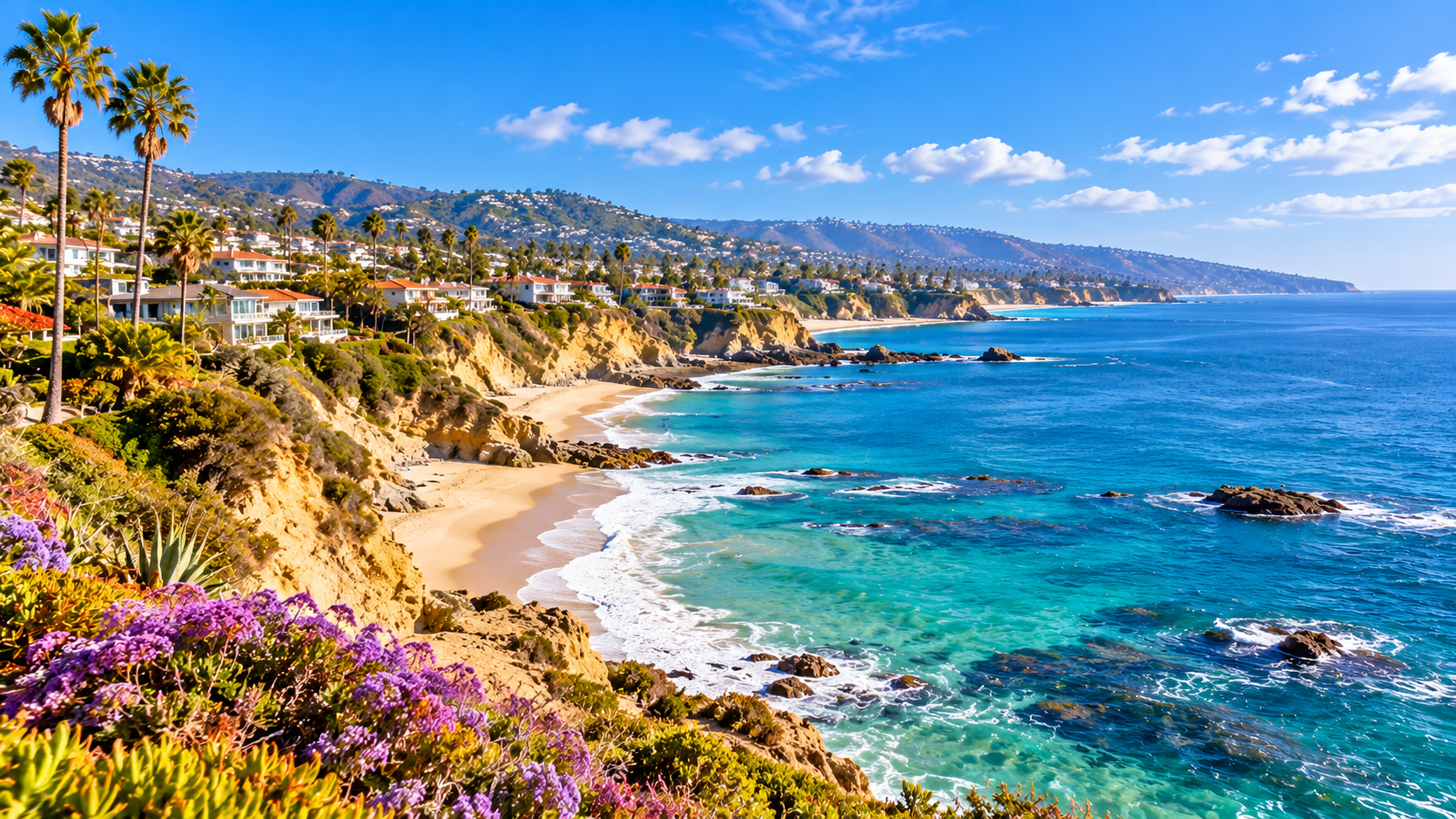
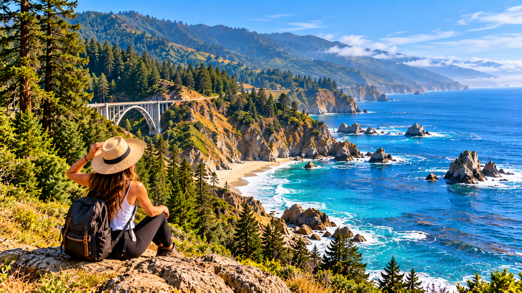
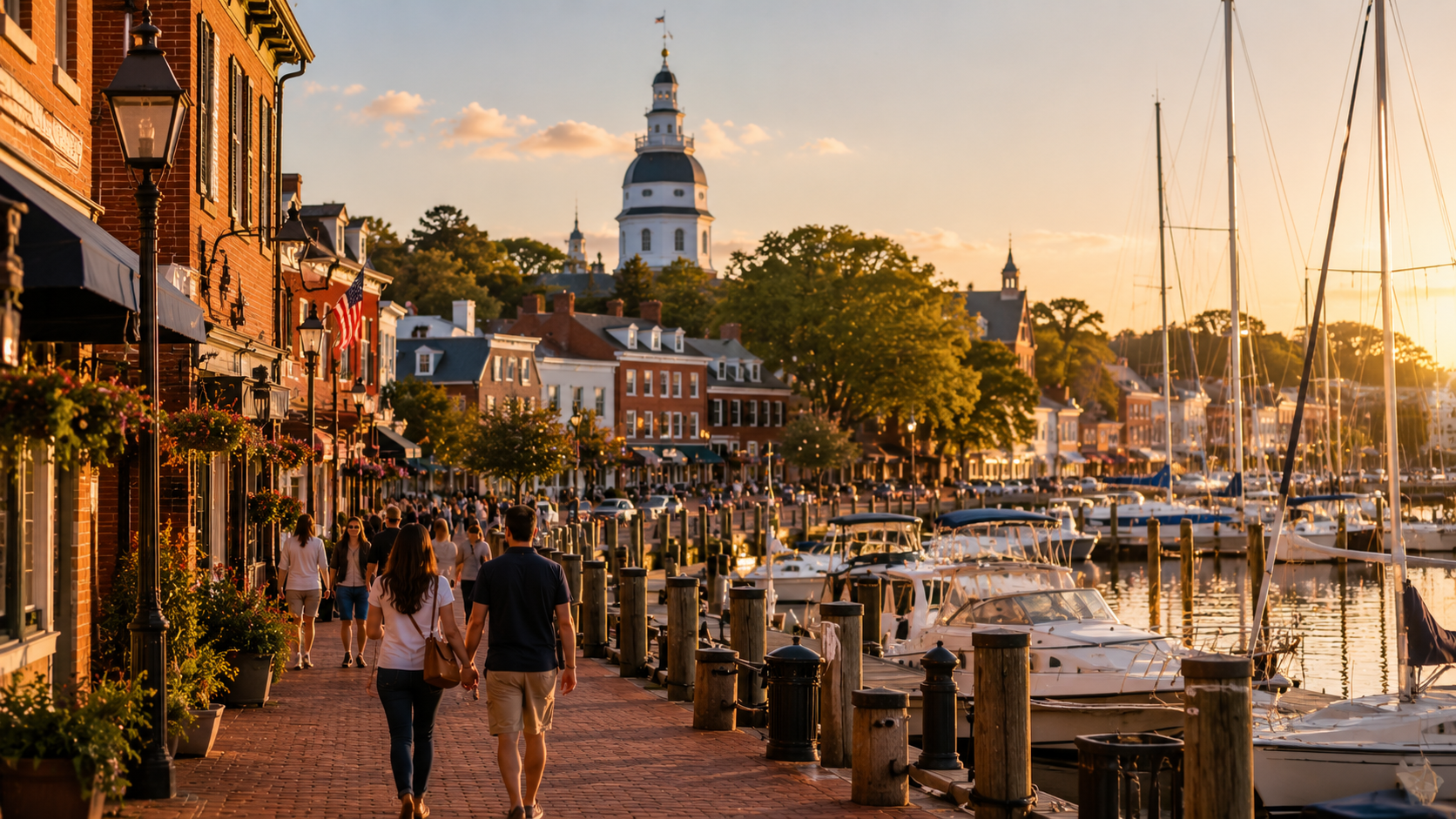
Central California stretches from the agricultural heart of the San Joaquin Valley to the Pacific coastline of Monterey and San Luis Obispo counties, with the Sierra Nevada rising dramatically along its eastern side. Its landscapes include coastal cliffs, fertile valleys, historic towns, granite mountains, giant sequoia forests, and some of California’s most recognizable national parks. Less a single destination and more a unified travel zone, Central California rewards travelers who choose routes based on geography rather than trying to connect every landmark in one journey. What works on a coastal drive through Monterey and Big Sur does not work in Yosemite or Sequoia, where mountain roads, elevation, weather, and seasonal access create very different planning requirements. The region also offers distinct cultural experiences, from Monterey’s maritime heritage and Paso Robles wine country to the agricultural communities of Fresno and Visalia. Understanding how the coast, Central Valley, and Sierra Nevada connect is the key to building a rewarding trip without unnecessary driving.
Travel Essentials
Discover Central California, where dramatic Pacific coastlines, charming seaside towns, fertile valleys and majestic Sierra Nevada mountains create an unforgettable journey. Explore Monterey Bay, Big Sur, San Luis Obispo, Santa Barbara, Fresno, Sequoia National Park and scenic routes toward Yosemite. Find essential travel information for planning your Central California adventure.
Central California Quick Facts
Essential information for exploring California’s Central Coast, Central Valley and Sierra Nevada.
Central California offers a remarkable combination of coastal beauty, agricultural heritage and mountain wilderness. Explore Monterey’s historic waterfront and aquarium, drive the dramatic Big Sur coastline, enjoy the vineyards of Paso Robles, discover the charming towns of San Luis Obispo County and experience Santa Barbara’s Mediterranean-style architecture. Inland, Fresno and Visalia provide access to Sequoia and Kings Canyon National Parks, while the Sierra Nevada offers spectacular forests, granite landscapes and outdoor adventures. Regional boundaries vary by source.
Arrival Information
Entry requirements and travel gateways for Central California.
Central California is a region, not a separate jurisdiction. International visitors follow United States entry requirements. Domestic travelers can reach the region by air, road or rail.
Passport & Visa
International visitors must meet U.S. passport and visa requirements. Eligible travelers may use the Visa Waiver Program with approved ESTA authorization.
International Arrival
Many visitors arrive through Los Angeles International Airport or San Francisco International Airport, then continue by car, domestic flight or rail.
Road Access
Highway 101, Interstate 5 and State Route 99 are major regional corridors. Highway 1 provides scenic coastal access where open.
Rail Arrival
Amtrak services connect parts of Central California with major California cities. Some destinations require connecting buses or other ground transport.
Domestic Flight ID
Adult passengers generally need a REAL ID-compliant license or another TSA-accepted form of identification for U.S. domestic flights.
Park Reservations
National park entry, campground reservations, timed-entry requirements and road access rules may change seasonally. Check official park notices before arrival.
Health Information
Healthcare access and environmental precautions across Central California.
Healthcare
Hospitals and urgent care facilities are available in major cities. Remote coastal and mountain destinations may be far from medical services.
Medical Insurance
U.S. medical care can be expensive. International visitors should consider travel medical insurance, including emergency transportation coverage.
Vaccinations
Keep routine vaccinations current and consult relevant health guidance before travel. Outdoor activities may involve ticks and other wildlife.
Heat Safety
Fresno, Bakersfield and other inland valleys can experience extreme summer heat. Carry water, avoid strenuous midday activity and monitor alerts.
Ocean Safety
Cold water, powerful currents and sneaker waves can make beaches dangerous. Follow posted warnings and avoid unstable cliffs and exposed rocks.
Wildfire Smoke
Wildfires can affect air quality, especially during dry and windy periods. Monitor air quality and evacuation notices when traveling.
Travel Advisory
Important safety considerations for coast, valley and mountain travel.
Check road conditions before every major drive. Highway 1 through Big Sur can close because of landslides, rockfalls or storm damage. Mountain routes may require tire chains or close during snow.
Highway 1 Closures
Big Sur’s coastal highway is vulnerable to landslides and washouts. Verify Caltrans conditions and plan alternate routes before departing.
Wildfire Risk
Wildfires may affect forests, foothills, roads and communities. Respect fire restrictions and follow evacuation instructions immediately.
Mountain Conditions
Snow and ice can affect Sierra Nevada roads from autumn through spring. Chain controls and seasonal road closures may apply.
Coastal Hazards
Never turn your back on ocean waves. Avoid unstable cliff edges and observe posted beach warnings along the Pacific coast.
Extreme Heat
Summer temperatures in the Central Valley can become dangerously high. Keep water in your vehicle and avoid leaving people or pets in parked cars.
Remote Areas
Some mountain roads and coastal stretches have limited cellular coverage, fuel stations and emergency services. Plan supplies accordingly.
Holidays & Festivals
National holidays and notable annual events in Central California.
Visitor Information
Everyday travel tips for Central California’s cities, coast and national parks.
Payments
U.S. dollars are used throughout the region. Cards are widely accepted, but some rural businesses and parking areas may have limited payment options.
Sales Tax & Tipping
Sales tax is usually added at checkout. Restaurant table-service tips of approximately 15–20% are customary, depending on service.
Languages
English is widely spoken. Spanish is also common, especially in agricultural communities and cities across the Central Valley.
Where to Stay
Monterey and Carmel suit coastal exploration; San Luis Obispo and Paso Robles offer central road-trip bases; Fresno and Visalia provide access to mountain parks.
Local Food & Wine
Enjoy fresh seafood, Santa Maria-style barbecue, farm produce, coastal wines and Paso Robles vineyards. Check winery reservation requirements.
Advance Planning
Reserve popular lodging, campgrounds, park activities and attraction tickets ahead of peak weekends. Big Sur accommodations can fill especially quickly.
Major Regional Airports
Airports serving Central California’s coast, valleys and mountain gateways.
Monterey Regional Airport
Convenient for Monterey, Carmel-by-the-Sea, Pacific Grove and northern Big Sur.
San Luis Obispo County Regional Airport
Gateway to San Luis Obispo, Pismo Beach, Morro Bay and Paso Robles.
Santa Barbara Airport
Serves Santa Barbara, Goleta, the Santa Ynez Valley and the southern Central Coast.
Fresno Yosemite International Airport
Major Central Valley airport and gateway toward Yosemite, Sequoia and Kings Canyon National Parks.
Meadows Field Airport
Serves Bakersfield and southern San Joaquin Valley communities.
Santa Maria Public Airport
Serves Santa Maria and surrounding Central Coast communities; scheduled passenger service may vary.
Transport in Central California
Explore coastal highways, inland valleys and mountain destinations.
Rental Car
A rental car is often the most flexible option for Big Sur, wineries, rural towns and national park gateways.
Highway 1
Scenic coastal route through Monterey, Big Sur and San Luis Obispo County. Check closures before driving.
Highway 101
Major north–south corridor linking Santa Barbara, San Luis Obispo, Salinas and other coastal communities.
Amtrak
The Pacific Surfliner, Coast Starlight and San Joaquins serve different parts of Central California, sometimes with bus links.
Regional Transit
Local bus systems serve cities such as Monterey, San Luis Obispo, Santa Barbara, Fresno and Bakersfield.
Park Transportation
National parks may operate seasonal shuttles or restrict certain roads. Verify park transport and parking information in advance.
Connectivity & Electricity
Mobile coverage, internet access and electrical standards in Central California.
Wi-Fi
Hotels, cafés, libraries and many visitor centers offer Wi-Fi. Remote campgrounds and scenic roads may have limited connectivity.
Mobile Networks
Major U.S. mobile providers serve cities and highways, but reception may be weak along Big Sur and in mountain valleys.
eSIM & Roaming
International visitors can consider U.S. eSIM or prepaid plans. Confirm coverage and roaming charges before traveling into remote areas.
Electricity
Standard U.S. electricity is 120V at 60Hz, using Type A and B plugs. International visitors may need an adapter or converter.
Laws & Etiquette
California regulations and responsible travel practices.
Alcohol & Cannabis
The minimum age to purchase alcohol and recreational cannabis is 21. Cannabis remains prohibited under federal law, including in national parks.
Driving Rules
Drive on the right. Seat belts are required and child restraint laws apply. Follow posted speed limits and hands-free device requirements.
Fire Restrictions
Campfires, charcoal grills and outdoor flames may be restricted during wildfire season. Always check current park and forest rules.
Coastal Protection
Respect protected habitats and marine wildlife. Do not approach seals, sea otters or nesting birds, and follow beach rules.
National Park Rules
Stay on designated trails where required, store food properly in bear country and avoid disturbing wildlife or removing natural objects.
Responsible Tourism
Respect private property, ranchland, vineyards and local communities. Use designated parking areas and leave natural spaces clean.
Emergency Information
Essential contacts for emergencies and travel assistance.
Call 911 for emergencies. In remote areas, provide your road number, mile marker, trail location or GPS coordinates when possible. Mobile service may be unreliable in mountainous and coastal terrain.
Medical Emergencies
Call 911 for urgent medical assistance. Remote wilderness incidents may require specialized rescue services and additional response time.
Wildfire Emergencies
Follow local emergency alerts, evacuation orders and official fire agency guidance. Leave immediately when directed.
Road Conditions
Check Caltrans QuickMap for closures, chain controls and traffic incidents before long drives.
Park Emergencies
Contact 911 when possible and notify park rangers or visitor center staff. Carry maps and emergency supplies in remote areas.
Central California Weather by Season
Understand the region’s coastal, valley and mountain climate differences.
Spring
March – MayGreen hills, wildflowers and generally pleasant coastal conditions. Mountain snow may linger at higher elevations.
Summer
June – AugustMild to cool coastal weather with occasional fog, intense inland valley heat and popular mountain recreation conditions.
Autumn
September – NovemberOften pleasant coastal weather, wine harvest activities and cooler inland temperatures. Wildfire risk can remain significant.
Winter
December – FebruaryCooler, wetter coastal and valley weather, with snow in the Sierra Nevada and possible storm-related road closures.
Central California travel tip: Spring and autumn are excellent for many coastal road trips. Summer brings warm inland conditions but can be cool and foggy near Monterey and Big Sur. Always check mountain weather, wildfire alerts and Highway 1 conditions before departure.
Understanding Central California’s Geography and Travel Regions
What Central California Includes
Central California has no single universally accepted boundary. For practical travel planning, this guide concentrates on the Central Coast, the San Joaquin Valley, and the central Sierra Nevada, including Monterey, San Benito, San Luis Obispo, Fresno, Madera, Merced, Kings, Tulare, and Mariposa counties.
Santa Cruz is included as a useful northern coastal gateway, while Yosemite’s wider mountain geography extends beyond the counties listed above. Some broader definitions of Central California also include other inland and coastal counties.
This guide does not treat San Francisco, Los Angeles, or the Lake Tahoe region as core Central California destinations, although they are important arrival points or onward connections.
The most useful distinction is between three major travel environments: the coast, the agricultural valley, and the mountains.
The Central Coast
The Central Coast includes Monterey Bay, Carmel-by-the-Sea, Big Sur, San Luis Obispo, Morro Bay, Cambria, and the surrounding coastal communities.
This is the most natural part of Central California for a scenic road trip. Highway 1 provides celebrated coastal scenery, while U.S. Highway 101 offers a more dependable inland corridor between many destinations.
Monterey Bay and San Luis Obispo County can be combined comfortably over several days, but the route should not be planned around Highway 1 alone. Closures and restrictions can make certain coastal segments inaccessible or require significant detours.
The San Joaquin Valley
The San Joaquin Valley forms Central California’s broad agricultural interior.
Fresno, Visalia, Merced, Madera, and Hanford are important cities and transportation centers. The valley’s orchards, vineyards, farms, and food-producing communities play a major role in California’s economy and cultural identity.
For visitors, the valley is often a gateway to Yosemite, Sequoia, and Kings Canyon national parks.
However, it deserves more than a passing glance. Agricultural heritage, regional food traditions, historic downtowns, and nearby foothill communities provide experiences distinct from the coast and mountains.
The Central Sierra Nevada
The Sierra Nevada contains some of Central California’s most dramatic natural landscapes.
Yosemite National Park, Sequoia National Park, Kings Canyon National Park, and surrounding national forests feature granite cliffs, waterfalls, giant sequoias, alpine environments, and extensive hiking opportunities.
These destinations are not interchangeable.
Yosemite is particularly associated with Yosemite Valley’s granite walls and waterfalls. Sequoia is renowned for its giant sequoia groves, while Kings Canyon combines deep mountain valleys with rugged wilderness.
Mountain travel requires more time than distances on a map might suggest. Winding roads, entrance congestion, weather, and seasonal closures all affect accessibility.
The Region’s Main Travel Corridors
U.S. Highway 101 connects much of the Central Coast and serves as a useful alternative to the more scenic but vulnerable sections of Highway 1.
California State Route 99 runs through the San Joaquin Valley, connecting cities including Merced, Fresno, and Visalia.
California State Route 41 provides an approach to Yosemite from the Fresno area, while State Route 140 connects Merced and Mariposa with Yosemite Valley.
State Route 198 is an important approach to Sequoia National Park from Visalia and Three Rivers.
The Sierra Nevada forms a substantial geographic barrier. Crossing the mountains is not always possible on the route that appears shortest, particularly when high-elevation passes are closed.
Major Arrival Gateways
San Francisco International Airport and San Jose Mineta International Airport are useful for Monterey Bay and northern Central Coast itineraries.
Fresno Yosemite International Airport provides convenient access to the San Joaquin Valley and several Sierra Nevada destinations.
San Luis Obispo County Regional Airport serves the southern Central Coast.
Los Angeles International Airport can also work for travelers beginning in southern San Luis Obispo County, but the drive north should be included in the itinerary.
The most efficient airport depends on whether the trip focuses on the coast, the mountains, or both.
Who Should Visit Central California?
Scenic Road Trip Travelers
Central California is especially rewarding for travelers who enjoy scenic driving and changing landscapes.
A coastal journey can connect Monterey, Carmel, Big Sur, Cambria, and San Luis Obispo, while an inland journey can explore Yosemite, Sequoia, and the surrounding foothills.
These routes provide very different experiences.
Travelers with limited time should choose one rather than attempting to complete both in a few days.
National Park Enthusiasts
Yosemite, Sequoia, and Kings Canyon make Central California a major destination for outdoor travelers.
Hiking, wildlife observation, photography, camping, and scenic viewpoints are important reasons to visit.
However, the parks require careful preparation. Popular areas can become crowded, accommodation is limited, and mountain conditions vary considerably by season.
Visitors planning several national parks should allow enough time for meaningful exploration rather than treating each park as a brief stop.
Couples and Relaxed Coastal Travelers
Carmel-by-the-Sea, Cambria, Morro Bay, and Paso Robles offer appealing settings for slower vacations.
Travelers can combine coastal walks, wine tasting, galleries, restaurants, and scenic countryside drives.
These destinations suit couples and visitors who prefer smaller towns to major metropolitan attractions.
A three- to five-night stay in one coastal or wine-country area can provide a more relaxed experience than constantly changing hotels.
Families
Families can enjoy Monterey Bay’s marine attractions, beaches, historic waterfronts, and accessible nature experiences.
Yosemite and Sequoia also offer memorable family activities, but hiking distances, elevation, weather, and park transportation should be considered carefully.
Families with younger children may prefer staying in one national-park area rather than combining several parks in a short trip.
Food and Wine Travelers
Paso Robles and the Edna Valley are notable wine destinations, while Monterey County offers agricultural communities, coastal seafood, and wine-growing areas.
The San Joaquin Valley provides a different culinary experience rooted in agriculture and diverse communities.
Travelers interested in food can build a rewarding itinerary around local markets, restaurants, wineries, and smaller towns.
Travelers Who May Prefer Another Region
Central California is less suitable for visitors seeking a vacation dominated by large-city nightlife, extensive urban public transportation, or major theme parks.
San Francisco and Los Angeles provide more concentrated metropolitan experiences.
Central California’s strengths lie in scenery, outdoor recreation, regional food, historic towns, and journeys between distinct landscapes.
Essential Central California Travel Basics
Entry Requirements and Documentation
Central California is part of the United States, so international visitors must follow applicable U.S. entry requirements.
Passport, visa, and Visa Waiver Program rules depend on nationality and individual circumstances.
The U.S. Department of State provides official visa and travel documentation guidance at travel.state.gov.
Visitors renting a vehicle should also confirm driver’s license requirements, insurance coverage, and rental-company policies.
Currency and Payments
The U.S. dollar is used throughout Central California.
Credit and debit cards are widely accepted at hotels, restaurants, attractions, and major businesses.
Carrying some cash can be useful for smaller markets and rural stops, although many businesses accept electronic payments.
Travelers should remember that advertised prices may exclude sales tax and that accommodation may involve additional parking or other fees.
How Many Days to Spend
Three or four days are sufficient for a focused visit to Monterey Bay, San Luis Obispo County, or one national park.
Five to seven days allow a more complete coastal itinerary or a Yosemite-focused vacation with nearby destinations.
Ten to fourteen days provide opportunities to combine the coast and Sierra Nevada, although doing so involves substantial driving.
Visitors should prioritize the experiences that matter most rather than assuming the entire region can be explored in one trip.
Reservations Worth Making Early
Accommodation in Yosemite Valley, Wawona, and other popular mountain areas can be difficult to secure during busy periods.
National-park campgrounds and certain activities may require reservations, while entrance and access procedures can change.
Popular coastal accommodation in Carmel, Big Sur, and Cambria can also book early during weekends and holiday periods.
The official California tourism organization provides destination information and regional planning resources at visitcalifornia.com.
Mobile Coverage and Navigation
Mobile coverage is generally reliable in larger towns and cities, but service may be limited along remote coastal roads, mountain highways, and national-park trails.
Download offline maps before entering remote areas.
Drivers should also carry sufficient fuel, particularly when traveling through less-developed sections of the Sierra Nevada.
Time Zones and Seasonal Changes
Central California follows Pacific Time.
Daylight saving time is generally observed, with seasonal clock changes affecting the amount of usable daylight during trips.
Winter days are shorter, which matters when planning mountain drives or lengthy coastal journeys.
Central California’s Major Cities and Destinations
Monterey: Marine Life and Coastal Heritage
Monterey is one of Central California’s most recognizable coastal destinations.
The historic waterfront, Cannery Row, Monterey Bay Aquarium, and nearby coastal communities offer a combination of maritime history, wildlife experiences, and sightseeing.
Monterey works particularly well for first-time visitors, families, and travelers interested in marine environments.
Two or three nights provide enough time to explore the city and nearby Pacific Grove and Carmel-by-the-Sea.
Carmel-by-the-Sea: Coastal Charm and Galleries
Carmel-by-the-Sea offers walkable streets, galleries, restaurants, and a picturesque beach setting.
Its atmosphere differs from Monterey’s larger waterfront and visitor attractions.
Carmel is particularly appealing for couples, art enthusiasts, and travelers seeking a relaxed coastal stay.
It combines naturally with Monterey, Point Lobos, and the northern section of Big Sur.
Big Sur: Dramatic Pacific Coastline
Big Sur is a coastal region rather than a conventional town.
Its rugged cliffs, forests, beaches, and scenic viewpoints make it one of California’s most celebrated driving destinations.
Visitors should allow time for stops and short walks rather than treating the drive as a race between endpoints.
Big Sur is also vulnerable to road closures and weather-related disruptions. Travelers should verify Highway 1 access before departure and avoid assuming the entire coastline is continuously passable.
San Luis Obispo: A Walkable Central Coast Base
San Luis Obispo offers a historic downtown, restaurants, cultural attractions, and convenient access to surrounding beaches and wine country.
It provides a useful base for exploring Pismo Beach, Avila Beach, Morro Bay, and the Edna Valley.
Two or three nights work well for a focused visit.
Travelers seeking a balance of urban conveniences and nearby natural attractions may find San Luis Obispo particularly practical.
Paso Robles: Wine Country and Countryside
Paso Robles is one of Central California’s principal wine destinations.
Its surrounding vineyards, tasting rooms, countryside landscapes, and restaurants appeal to wine enthusiasts and couples.
The city also serves as a useful inland stop between the coast and the San Joaquin Valley.
Two or three nights allow a relaxed introduction, particularly for travelers planning winery visits.
Fresno: Gateway to the Sierra Nevada
Fresno is the largest major city in the central San Joaquin Valley and an important gateway to the Sierra Nevada.
It provides extensive accommodation, dining, shopping, and transportation services.
The city is particularly useful for travelers approaching Yosemite’s southern entrance or exploring nearby foothill destinations.
However, Fresno is not located inside Yosemite, and travel to the park requires additional driving.
Visalia: Access to Sequoia Country
Visalia is a practical base for exploring Sequoia National Park and the surrounding foothills.
Its downtown restaurants, accommodation options, and proximity to Three Rivers make it useful for visitors who prefer to stay outside the park.
Travelers should still allow sufficient time for mountain roads and entrance congestion.
Two or three nights in the area are reasonable for a focused Sequoia visit.
Mariposa: Historic Yosemite Gateway
Mariposa is a historic foothill town west of Yosemite National Park.
Its location along the State Route 140 corridor makes it a useful accommodation option for travelers approaching Yosemite Valley.
The town offers historic buildings, local businesses, and a quieter setting than the park’s busiest visitor areas.
Mariposa works best as a gateway rather than as a substitute for time spent inside Yosemite.
Central California’s Natural Highlights
Yosemite National Park: Granite Valleys and Waterfalls
Yosemite National Park is one of the defining destinations of the Sierra Nevada. Yosemite Valley is famous for El Capitan, Half Dome, Yosemite Falls, Bridalveil Fall, and its dramatic glacially shaped landscape.
The park extends well beyond the valley, encompassing high-country meadows, forests, lakes, and wilderness. Visitors should allow at least two full days for a first experience, with three or four days preferable for hiking and exploring beyond the main viewpoints.
Yosemite is especially busy during warmer months. Accommodation and camping should be reserved early, and visitors must check current entrance, wilderness-permit, and activity requirements.
For 2026, the National Park Service states that a reservation is not required simply to enter Yosemite, although separate reservations and permits remain necessary for certain activities and overnight stays. Verify the latest requirements at nps.gov/yose.
Sequoia National Park: Ancient Giant Trees
Sequoia National Park protects remarkable groves of giant sequoias, including the General Sherman Tree in Giant Forest.
The park’s mountainous landscape also includes granite peaks, meadows, rivers, and hiking trails. Giant Forest and nearby attractions are the main priorities for many first-time visitors.
Allow at least one full day, although two days are preferable if combining scenic drives and hikes.
Access is primarily by mountain roads, and winter weather can affect which areas are reachable. Sequoia combines naturally with Kings Canyon but should not be treated as a quick stop between distant coastal cities.
Kings Canyon National Park: Forests and Deep Mountain Valleys
Kings Canyon National Park combines giant sequoia groves with steep canyons, mountain rivers, and extensive wilderness.
Grant Grove provides relatively accessible giant sequoia experiences, including the General Grant Tree. Cedar Grove lies deeper in the canyon and requires additional driving on a seasonal mountain road.
Travelers with limited time may concentrate on Grant Grove and nearby Sequoia attractions. Reaching Cedar Grove deserves additional time, especially if hiking is a priority.
The park is most straightforward to explore during periods when its major mountain roads are open.
Big Sur’s Cliffs and Coastal Parks
Big Sur contains some of California’s most dramatic coastal landscapes, with mountains descending steeply toward the Pacific.
Notable destinations include Pfeiffer Big Sur State Park, Garrapata State Park, and the coastal area around McWay Falls.
Visitors can combine scenic viewpoints with forest walks and beach access where permitted.
The main challenge is transportation. Highway 1 is narrow in places, and closures can change which attractions are accessible from Monterey or San Luis Obispo County.
A full day is appropriate for a northern Big Sur excursion, while two days allow a more relaxed coastal experience when road access permits.
Point Lobos State Natural Reserve
Point Lobos lies south of Carmel-by-the-Sea and is renowned for rocky coves, coastal trails, marine wildlife, and Monterey cypress landscapes.
It is one of the most rewarding short nature excursions from Monterey or Carmel.
Visitors should allow several hours rather than treating it as a roadside viewpoint.
Parking can be limited, particularly during busy periods, and visitors must follow protected-area restrictions.
Pinnacles National Park
Pinnacles National Park lies inland from the Monterey Bay area and protects unusual volcanic rock formations, talus caves, and habitats used by California condors.
The park has eastern and western entrances, but no road connects them through the park. Travelers must choose their entrance according to the hikes they intend to undertake.
Pinnacles is particularly appealing for hikers, climbers, birdwatchers, and travelers seeking a less coastal experience.
Spring and fall generally offer more comfortable hiking conditions than the hottest summer periods.
Morro Bay and the Central Coast Estuaries
Morro Bay is recognizable for Morro Rock, the large volcanic formation near the harbor entrance.
The surrounding estuary supports birds and other wildlife, making the area appealing for kayaking, walking, and nature observation.
Nearby Montaña de Oro State Park offers coastal trails, beaches, and scenic headlands.
Morro Bay works well as a two-night destination or a day trip from San Luis Obispo.
The Sierra Nevada High Country
Beyond Yosemite Valley and the main sequoia groves, the Sierra Nevada contains alpine lakes, mountain passes, wilderness trails, and high-elevation scenery.
These areas are particularly attractive to experienced hikers and travelers interested in mountain photography.
Access depends heavily on snow conditions, and some roads remain closed well into spring or early summer.
High-country exploration should be planned separately from short national-park sightseeing visits.
Central California’s Cultural and Historic Must-Sees
Monterey’s Maritime and Literary Heritage
Monterey’s historic waterfront reflects the city’s importance in California’s early political, commercial, and maritime history.
The city’s preserved buildings and museums provide opportunities to explore Spanish and Mexican California, the fishing industry, and later cultural developments.
Cannery Row is associated with the region’s former sardine industry and the writing of John Steinbeck.
Visitors can combine historic sightseeing with waterfront walks and nearby marine attractions.
Hearst Castle and San Simeon
Hearst Castle, near San Simeon, is one of Central California’s most distinctive historic landmarks.
Built for newspaper publisher William Randolph Hearst, the hilltop estate is known for its architecture, art collections, gardens, and expansive coastal views.
Guided tours are the principal way to experience the property, and advance reservations are advisable.
The site combines naturally with Cambria, San Simeon, and a coastal itinerary through San Luis Obispo County.
California State Parks provides official tour and visitor information through hearstcastle.org.
San Luis Obispo’s Mission and Downtown
Mission San Luis Obispo de Tolosa is an important historic landmark in the city’s downtown.
The surrounding streets contain restaurants, shops, and cultural venues, creating a walkable environment for visitors.
The mission provides an opportunity to learn about Spanish colonial history, but its interpretation should also acknowledge the experiences of the Indigenous communities affected by the mission system.
A half-day or full day is sufficient for a relaxed downtown visit.
Indigenous Heritage Across Central California
Central California has long been home to Indigenous peoples, including Ohlone, Esselen, Salinan, Chumash, Yokuts, Miwok, and Mono communities, among others.
These communities have distinct histories, languages, cultural traditions, and relationships with the region’s landscapes.
Travelers can learn about Indigenous heritage through museums, tribal cultural initiatives, historic sites, and interpretive programs.
Indigenous history should not be presented solely as something from the past. Tribal communities continue to shape Central California’s cultural identity today.
Steinbeck Country and the Salinas Valley
The Salinas Valley is closely associated with author John Steinbeck and the agricultural landscapes that influenced his writing.
Salinas provides opportunities to explore literary history, while the surrounding valley reveals the agricultural setting of many of his works.
This is a worthwhile extension for visitors interested in literature, regional history, and California’s agricultural heritage.
It combines naturally with Monterey and nearby inland communities.
Gold Rush Foothill Communities
The Sierra Nevada foothills contain towns shaped by nineteenth-century mining, transportation, and settlement.
Mariposa and other historic communities offer preserved buildings, local museums, and streetscapes that provide context for California’s development.
These towns work particularly well as stops on the way to Yosemite.
Visitors should also recognize that Gold Rush expansion brought violence, dispossession, and profound disruption to Indigenous communities.
Where to Go in Central California Based on Your Interests
For a First Coastal Road Trip
Monterey, Carmel-by-the-Sea, Big Sur, Cambria, Morro Bay, and San Luis Obispo form a compelling coastal route.
This journey combines marine wildlife, scenic drives, historic towns, and regional dining.
Five to seven days provide a comfortable introduction, assuming road access supports the intended route.
Travelers should check Highway 1 conditions before departure and use U.S. Highway 101 where necessary.
The main tradeoff is that adding Yosemite or Sequoia creates a substantially different journey requiring additional driving and overnight stays.
For a Yosemite-Focused Vacation
Yosemite deserves at least two or three days for a first visit.
Travelers can base themselves inside the park, near El Portal, in Mariposa, or around Oakhurst, depending on availability and preferred entrances.
A Yosemite-focused trip can include nearby foothill communities without requiring long transfers to other national parks.
Visitors interested primarily in waterfalls, granite landscapes, and hiking may prefer this approach to a broader but rushed itinerary.
For Giant Sequoias and Mountain Forests
Sequoia and Kings Canyon national parks are the strongest combination for travelers who want to experience giant sequoia forests and mountain scenery.
Three or four days allow time for Giant Forest, Grant Grove, scenic viewpoints, and selected hikes.
Visalia, Three Rivers, and the Grant Grove area provide different accommodation options.
The main limitation is seasonal road access, particularly for deeper canyon destinations.
For Wine Country and Countryside
Paso Robles and the surrounding wine country offer tasting rooms, vineyard landscapes, restaurants, and smaller-town experiences.
The Edna Valley near San Luis Obispo provides another wine-growing area with a different coastal influence.
Three or four days allow a relaxed combination of wine tasting, dining, and countryside exploration.
This route is best suited to couples and food travelers rather than visitors whose main priority is national-park hiking.
For Marine Wildlife and Coastal Nature
Monterey Bay, Point Lobos, Pacific Grove, and Morro Bay are excellent destinations for travelers interested in coastal ecosystems.
Depending on the season and conditions, visitors may observe sea otters, harbor seals, seabirds, and migrating whales.
Wildlife encounters cannot be guaranteed, and responsible viewing distances are essential.
Four or five days allow time for a combination of coastal walks, marine attractions, and selected wildlife experiences.
For Quieter Historic Towns
Cambria, San Juan Bautista, Mariposa, and smaller foothill communities provide alternatives to busier tourist centers.
These destinations appeal to travelers who enjoy architecture, local history, galleries, and a slower pace.
They work best as part of a geographically connected route rather than as unrelated stops scattered across the region.
Central California Food and Drink Experiences
Monterey Bay Seafood
Monterey and nearby coastal communities have longstanding connections to commercial fishing and seafood.
Restaurants offer dishes influenced by local maritime traditions, including seafood stews, grilled fish, and shellfish.
The historic fishing industry also shaped Monterey’s waterfront and cultural identity.
Travelers interested in sustainable seafood should ask about sourcing rather than assuming all seafood served locally was caught in Monterey Bay.
Salinas Valley Agriculture
The Salinas Valley is one of California’s major agricultural regions, particularly associated with vegetable production.
Its agricultural landscapes are a defining feature of the drive between Monterey and inland communities.
Local markets, farm-related experiences, and restaurants provide opportunities to appreciate the region’s food production.
Travelers should remember that the valley is a working agricultural landscape, not simply a scenic attraction.
Paso Robles Wine Country
Paso Robles is known for wine production, including Cabernet Sauvignon, Rhône-style varieties, and other regional wines.
The surrounding countryside contains wineries and tasting rooms ranging from smaller producers to larger estates.
Wine-focused visitors should reserve selected tastings in advance, especially during weekends.
A designated driver or suitable transportation arrangement is important when visiting multiple wineries.
San Luis Obispo and Edna Valley
San Luis Obispo offers a varied restaurant scene influenced by nearby farms, vineyards, and coastal communities.
The Edna Valley is particularly associated with cool-climate wines, including Chardonnay and Pinot Noir.
Travelers can combine a downtown food experience with a countryside excursion.
This area is particularly appealing for visitors who want wine-country activities without spending their entire vacation at wineries.
San Joaquin Valley Food Traditions
The San Joaquin Valley’s cuisine reflects its agricultural economy and diverse communities.
Mexican, Armenian, Hmong, Punjabi, Portuguese, and other cultural influences contribute to the region’s food landscape, although their presence varies by city.
Fresno is particularly rewarding for travelers interested in exploring food traditions beyond coastal California.
Local restaurants, bakeries, markets, and community events offer opportunities to experience the valley’s cultural diversity.
Farmers Markets and Seasonal Produce
Central California’s agricultural abundance makes farmers markets a worthwhile addition to many itineraries.
San Luis Obispo, Monterey, Fresno, and other communities host markets featuring produce, prepared foods, and local vendors.
Seasonal offerings vary, with berries, stone fruit, grapes, citrus, and vegetables appearing at different times of year.
Check operating schedules before planning a market visit, since some take place only on particular days.
Getting Around Central California: Roads, Rail, and Mountain Access
Driving the Central Coast
A rental car is the most flexible way to explore Central California’s coastline, particularly when visiting Big Sur, smaller beach towns, wineries, and state parks.
U.S. Highway 101 is the principal north–south route connecting Salinas, Paso Robles, San Luis Obispo, and communities farther south. Highway 1 follows a more scenic coastal alignment in many areas, but it is generally slower and more vulnerable to closures.
Travelers should not assume that Highway 1 provides an uninterrupted drive between Monterey and San Luis Obispo. Landslides, road repairs, and weather-related restrictions can affect access.
Before finalizing a coastal itinerary, use the California Department of Transportation’s official road-information service at quickmap.dot.ca.gov to check closures and travel conditions.
If Highway 1 is unavailable through Big Sur, U.S. Highway 101 provides an inland alternative. However, using that detour changes the sightseeing experience and may require separate excursions to northern and southern Big Sur.
Traveling Between the Coast and Sierra Nevada
The Central Coast and Sierra Nevada are separated by the San Joaquin Valley and several mountain ranges.
Driving from Monterey to Yosemite Valley generally requires a substantial portion of the day once traffic, mountain roads, and stops are considered.
San Luis Obispo to Sequoia National Park also involves a lengthy inland journey, making an overnight stop or a dedicated travel day advisable.
Approximate driving times under favorable conditions include:
- Monterey to San Luis Obispo: 2–2.5 hours via U.S. Highway 101.
- Monterey to Yosemite Valley: 3.5–5 hours.
- Fresno to Yosemite Valley: 2–2.5 hours.
- Fresno to Sequoia’s Giant Forest: 2–3 hours.
- Visalia to Sequoia’s Giant Forest: 1.5–2.5 hours.
- San Luis Obispo to Visalia: 2.5–3.5 hours.
- Monterey to Santa Cruz: 45–75 minutes.
These are broad driving estimates, not guaranteed travel times. Mountain traffic, weather, entrance queues, and seasonal restrictions can extend them significantly.
Accessing Yosemite National Park
Yosemite has several western approach routes, each serving different gateway communities.
State Route 140 connects Merced and Mariposa with Yosemite Valley through the Merced River canyon. State Route 41 approaches the park from Fresno and Oakhurst, while State Route 120 provides another western approach through the Groveland area.
Tioga Road crosses the park’s high country toward the eastern Sierra Nevada, but it is seasonal and may remain closed for many months because of snow.
A traveler arriving from Fresno should not assume the same entrance is best for every Yosemite destination.
For most first-time visitors, selecting accommodation near the intended park entrance can reduce daily driving.
Driving to Sequoia and Kings Canyon
Sequoia and Kings Canyon have separate western approaches.
State Route 198 enters Sequoia through Three Rivers, while State Route 180 provides access to Kings Canyon’s Grant Grove area from Fresno.
The Generals Highway connects major areas of the two parks when conditions permit. However, portions of the route may close during winter, and access to Cedar Grove is seasonal.
The National Park Service warns that some park roads are steep, narrow, and unsuitable for larger vehicles. Check the official road guidance at nps.gov/seki/planyourvisit before traveling.
Drivers should also note that gasoline and charging facilities are not available within the parks themselves.
Rail Travel Through Central California
Passenger rail can be useful for selected city-to-city journeys, but it does not provide comprehensive access to Central California’s natural attractions.
Amtrak’s San Joaquins corridor serves communities in the San Joaquin Valley, while connecting transportation services provide additional regional links.
The Coast Starlight serves selected Central Coast destinations, including Salinas, Paso Robles, and San Luis Obispo.
Rail can reduce the need for long-distance driving between certain cities. However, visitors will still need additional transportation for Big Sur, most wineries, and many national-park destinations.
Travelers should verify schedules, station locations, and connecting services before deciding to travel without a car.
Regional Buses and Park Transportation
Regional bus systems operate in several Central California communities, but coverage varies considerably.
YARTS, the Yosemite Area Regional Transportation System, provides access to Yosemite from selected gateway communities along established corridors, with services varying by route and season.
Within Yosemite, park shuttle systems serve certain areas, but they do not replace the need to plan transportation to the park.
Sequoia also operates seasonal shuttle services in selected areas.
Public transportation is most practical for travelers who carefully coordinate accommodation, arrival points, and park access.
When Flying Makes Sense
Flying between Central California destinations is rarely necessary for a conventional road trip.
However, arriving through Fresno can save considerable driving for travelers focused on Yosemite, Sequoia, or Kings Canyon.
San Luis Obispo County Regional Airport is useful for southern Central Coast trips, while San Jose and San Francisco serve northern coastal itineraries.
For a one-way journey, compare different arrival and departure airports against the cost of returning a rental car to another location.
Where to Stay in Central California
Monterey or Carmel for the Northern Coast
Monterey and Carmel-by-the-Sea are strong bases for exploring Monterey Bay, Pacific Grove, Point Lobos, and northern Big Sur.
Monterey offers a broad selection of accommodation and convenient access to waterfront attractions.
Carmel provides a quieter village atmosphere, galleries, and scenic coastal surroundings.
Two or three nights are appropriate for a focused visit, while four nights allow more relaxed excursions.
Neither location is a practical daily base for Yosemite or the southern Central Coast.
San Luis Obispo for Coastal Variety
San Luis Obispo is one of Central California’s most versatile bases.
Visitors can explore downtown attractions, nearby beaches, Morro Bay, the Edna Valley, and portions of northern San Luis Obispo County.
It offers a useful balance between urban services and access to smaller coastal communities.
Three nights provide enough time for several excursions without repeatedly changing hotels.
Paso Robles for Wine Country
Paso Robles is particularly suitable for travelers prioritizing wine tasting, countryside drives, and restaurants.
Staying locally avoids repeated travel between tasting areas and more distant coastal accommodation.
Two or three nights allow time for a relaxed visit.
Travelers primarily interested in beaches may prefer San Luis Obispo, Cambria, or Morro Bay instead.
Mariposa or El Portal for Yosemite
Mariposa and El Portal are useful western gateway communities for Yosemite.
El Portal is closer to Yosemite Valley, while Mariposa offers a historic town setting with a wider range of services.
Accommodation inside Yosemite can reduce daily travel, but availability and prices may be challenging during busy periods.
For a first visit, two or three nights in or near the park are preferable to repeated long-distance day trips.
Oakhurst for Yosemite’s Southern Approach
Oakhurst is useful for travelers approaching Yosemite from Fresno or exploring the park’s southern areas.
It also provides access to nearby foothill attractions and services.
However, reaching Yosemite Valley still requires a mountain drive.
Oakhurst is most suitable for travelers who understand the difference between being near a park entrance and being near the park’s main sightseeing areas.
Three Rivers or Visalia for Sequoia
Three Rivers lies near Sequoia National Park’s southern entrance and is particularly convenient for travelers planning early park visits.
Visalia offers more extensive urban services and accommodation choices but requires a longer drive to the park.
Both are useful bases for exploring Giant Forest and nearby attractions.
Visitors planning to spend several days in Kings Canyon should also consider accommodation closer to Grant Grove, subject to availability and seasonal access.
Fresno for Regional Connections
Fresno is useful as a transportation and service hub.
It provides access to major highways, an airport, restaurants, and accommodation options.
However, staying in Fresno for several consecutive national-park days can involve substantial commuting.
It works best for travelers making regional connections or exploring several parts of the central San Joaquin Valley.
Central California Travel Budget Tracker
Central California’s travel costs vary considerably between coastal resorts, agricultural cities, foothill towns, and national-park accommodation.
Carmel, Big Sur, and popular Yosemite lodging can be relatively expensive, particularly during busy periods.
Fresno, Visalia, and some inland communities may offer more economical accommodation, but lower room rates should be weighed against additional driving.
Budget Travel: Approximately $100–$175 Per Day
Budget travelers can reduce costs by choosing modest hotels, hostels where available, campgrounds, and casual restaurants.
Inland communities often provide better accommodation value than prime coastal locations.
However, travelers visiting national parks should account for entrance fees, transportation, equipment, and possible camping reservations.
Sharing a rental car and accommodation can significantly reduce per-person expenses.
Mid-Range Travel: Approximately $180–$325 Per Day
Mid-range travelers can plan for comfortable accommodation, restaurants, a rental car, and several paid attractions.
A combination of coastal hotels and inland accommodation can help balance costs.
For a national-park trip, staying closer to the park may cost more but reduce time spent commuting.
Wine tastings, guided experiences, and premium coastal accommodation can push spending toward the upper end of this range.
Higher-End Travel: Approximately $350–$700+ Per Day
Luxury coastal accommodation, upscale dining, premium winery experiences, and distinctive resorts can increase daily costs substantially.
Carmel, Big Sur, and select Paso Robles properties are particularly relevant to higher-end travel.
Availability can be limited during popular weekends and holidays.
Travelers seeking luxury accommodation inside or near national parks should reserve well in advance.
Main Expenses to Consider
Accommodation: Coastal towns and national-park properties often command higher rates than inland cities.
Rental cars: Fuel, insurance, parking, and possible one-way rental charges can add considerably to a regional itinerary.
National parks: Entrance fees, camping, and certain activities may require separate payments.
Food and wine: Casual dining is widely available, but tasting fees and fine dining can increase costs.
Transportation: Remote destinations may require additional fuel and longer drives.
Seasonal pricing: Summer, holidays, major events, and popular weekends can raise accommodation costs.
These daily ranges are approximate per person, assuming two travelers share a room and basic vehicle costs. They exclude flights to California and unusually expensive activities.
How to Reduce Total Trip Costs
A focused itinerary is usually more economical than one that repeatedly crosses the region.
Travelers interested in Monterey and Big Sur can stay along the northern coast rather than adding several inland destinations.
Those prioritizing Sequoia and Kings Canyon can use one or two mountain-area bases instead of commuting from distant coastal hotels.
Booking accommodation early and choosing a realistic route often provide more value than selecting the lowest nightly room rate.
Which Central California Sub-Region Fits Your Trip?
Monterey Bay and Northern Big Sur
This sub-region includes Monterey, Pacific Grove, Carmel-by-the-Sea, Point Lobos, and the northern Big Sur coastline.
It is best suited to first-time coastal visitors, couples, families, and travelers interested in marine wildlife.
Three to five days provide a comfortable introduction.
A car is useful for Point Lobos and Big Sur, although parts of Monterey and Carmel can be explored on foot.
The main tradeoff is accommodation cost, particularly in desirable coastal locations.
San Luis Obispo County Coast
San Luis Obispo, Morro Bay, Cambria, Pismo Beach, and nearby coastal communities form another coherent travel area.
This region offers beaches, historic towns, scenic headlands, and a slower pace than California’s largest metropolitan areas.
Four to six days allow time to explore several communities without excessive driving.
A car is strongly recommended for reaching smaller towns and state parks.
This area combines naturally with Paso Robles wine country.
Paso Robles and Inland Wine Country
Paso Robles and surrounding countryside form a distinct inland travel zone.
It is best suited to wine enthusiasts, couples, and travelers interested in food and rural landscapes.
Two to four days are appropriate for a focused visit.
Summer can be hot, while spring and fall often provide more comfortable conditions for outdoor activities.
Visitors should arrange safe transportation for winery excursions.
Yosemite and the Central Sierra Foothills
Yosemite, Mariposa, Oakhurst, and nearby foothill communities form a practical mountain travel system.
This area is ideal for hikers, photographers, national-park enthusiasts, and families interested in outdoor experiences.
Three to five days are appropriate for a first visit.
A vehicle offers flexibility, although selected bus and shuttle connections can be useful.
Seasonal road conditions strongly influence which areas can be explored.
Sequoia, Kings Canyon, and the Southern Sierra
This sub-region includes Visalia, Three Rivers, Grant Grove, Giant Forest, and the accessible portions of Kings Canyon.
It is particularly suitable for travelers interested in giant sequoias, mountain forests, and scenic hiking.
Three to five days provide enough time for the main highlights, depending on seasonal access.
Travelers should plan around mountain driving rather than assuming the parks are close together simply because they share a management system.
The San Joaquin Valley
Fresno, Merced, Madera, Visalia, Hanford, and surrounding agricultural communities form Central California’s principal inland corridor.
This area is particularly useful for transportation connections, regional food exploration, and access to the Sierra Nevada.
Two or three days may be worthwhile for travelers interested in agricultural heritage and cultural communities.
For visitors whose main goal is Yosemite or Sequoia, the valley often functions as a gateway rather than the primary destination.
Realistic Central California Road Trip Itineraries
Central California is large enough that itinerary planning should begin with a choice between the coast, the mountains, or a longer journey combining both.
A coastal road trip is generally easier to organize around Highway 101 and selected Highway 1 excursions. A national-park itinerary requires more attention to entrance roads, accommodation availability, and seasonal mountain access.
The following routes prioritize realistic travel days and manageable hotel changes.
Five-Day Monterey Bay and Big Sur Escape
This itinerary is designed for travelers who want a focused coastal experience without traveling the entire Central Coast.
Day 1: Arrive in Monterey
Arrive through San Jose, San Francisco, or another convenient gateway and travel to Monterey.
Spend the afternoon exploring the historic waterfront and Cannery Row.
Stay in Monterey or Carmel for the next several nights to avoid unnecessary hotel changes.
Day 2: Monterey Bay Exploration
Dedicate the day to Monterey’s marine attractions, historic sites, and waterfront neighborhoods.
Travelers interested in marine life can visit the Monterey Bay Aquarium or enjoy a coastal walk.
Allow time for dining and a relaxed evening.
Day 3: Carmel and Point Lobos
Explore Carmel-by-the-Sea’s village streets, galleries, and beach.
Continue to Point Lobos for coastal trails and scenic viewpoints.
Return to your accommodation rather than adding a long drive.
Day 4: Northern Big Sur
Drive south along the accessible section of Highway 1, stopping at scenic viewpoints and coastal parks.
Select attractions according to current road access and parking availability.
Return to Monterey or Carmel for the evening.
Day 5: Pacific Grove and Departure
Enjoy a final coastal walk or breakfast before returning to your departure airport.
Travelers with additional time can extend south toward San Luis Obispo County, but that is better treated as a separate road-trip segment.
Seven-Day Central Coast Road Trip
This itinerary links Monterey Bay with San Luis Obispo County and works best when travelers can enter and leave through different airports.
Day 1: Monterey Arrival
Arrive in Monterey and explore the waterfront.
Spend the night locally.
Day 2: Carmel and Point Lobos
Visit Carmel-by-the-Sea and Point Lobos.
Enjoy the area’s coastal scenery and restaurants without rushing.
Day 3: Big Sur Scenic Excursion
Explore accessible sections of Big Sur.
If Highway 1 is fully open along the intended route, continue south toward Cambria. Otherwise, return to the Highway 101 corridor and reach the southern coast through an inland route.
Day 4: Cambria and San Simeon
Explore Cambria, San Simeon, and the surrounding coastline.
Consider a guided tour of Hearst Castle.
Spend the night in Cambria or nearby.
Day 5: Morro Bay and Coastal Parks
Continue south toward Morro Bay.
Explore the harbor, estuary, and nearby Montaña de Oro State Park.
Spend the night in San Luis Obispo or Morro Bay.
Day 6: San Luis Obispo and Edna Valley
Explore downtown San Luis Obispo, nearby beaches, or the Edna Valley.
Travelers interested in wine can arrange a tasting excursion.
Keep the day relatively relaxed.
Day 7: Departure
Depart through San Luis Obispo or another suitable airport.
If returning to San Francisco or Los Angeles, account for the additional drive and avoid scheduling demanding sightseeing before the flight.
Seven-Day Yosemite National Park Journey
This route focuses on Yosemite and nearby foothill communities rather than attempting to combine several distant parks.
Day 1: Arrive in Fresno or Merced
Arrive in the region and collect a rental car if needed.
Travel toward your selected Yosemite gateway accommodation.
Use the remainder of the day for supplies and preparation.
Day 2: Yosemite Valley Introduction
Enter Yosemite and explore its principal valley viewpoints.
Allow time for El Capitan, Yosemite Falls, and other accessible landmarks.
Avoid overloading the first day with lengthy hikes.
Day 3: Yosemite Valley Hiking
Dedicate the day to selected hikes appropriate for your fitness level and current trail conditions.
Enjoy the valley’s granite landscapes, waterfalls, and meadows.
Start early during busy periods.
Day 4: Southern Yosemite
Explore the Wawona area or Mariposa Grove, depending on access and interests.
This provides a different experience from Yosemite Valley.
Return to your accommodation for the evening.
Day 5: Yosemite High Country
If Tioga Road is open, explore selected high-country destinations such as Tuolumne Meadows.
If the road is closed, substitute additional valley activities, foothill exploration, or accessible park areas.
Do not plan this day around a guaranteed high-country crossing.
Day 6: Mariposa and Foothill Heritage
Spend time exploring Mariposa or another nearby foothill community.
Visit local historic sites, restaurants, and shops.
This slower day provides a break from more demanding park activities.
Day 7: Departure
Return toward Fresno, Merced, or another suitable departure gateway.
Allow extra time for mountain roads and possible traffic.
Seven-Day Sequoia and Kings Canyon Adventure
This itinerary is designed for travelers interested in giant sequoias, mountain forests, and scenic hiking.
Day 1: Arrive in Visalia
Arrive in Visalia and settle into accommodation.
Explore downtown or prepare supplies for the park.
Day 2: Sequoia National Park
Travel into Sequoia National Park through Three Rivers.
Explore Giant Forest and visit the General Sherman Tree.
Allow plenty of time for the winding mountain drive.
Day 3: Sequoia Trails and Viewpoints
Spend another day exploring accessible trails and viewpoints.
Choose hikes according to weather, road access, and fitness.
Return to accommodation near the park.
Day 4: Travel Toward Grant Grove
Continue toward Kings Canyon’s Grant Grove area using an open, suitable route.
Visit the General Grant Tree and nearby forest trails.
Stay in or near the Grant Grove area if accommodation is available.
Day 5: Kings Canyon Exploration
Explore Grant Grove or continue toward Cedar Grove when the seasonal road is open.
If Cedar Grove is inaccessible, spend additional time on nearby trails and scenic areas.
Avoid assuming that all parts of Kings Canyon are reachable year-round.
Day 6: Mountain Forests and Recovery
Enjoy a slower day with selected walks, scenic viewpoints, or nearby national forest destinations.
This provides flexibility if earlier activities were affected by weather.
Day 7: Return to Fresno or Visalia
Drive toward your departure city.
Allow sufficient time for mountain roads and airport transfers.
Fourteen-Day Coast and Sierra Nevada Journey
Two weeks allow travelers to combine Central California’s coastal and mountain environments without rushing through every destination.
This route is particularly suitable for late spring through early fall, although high-elevation access must still be verified.
Day 1: Arrive in Monterey
Arrive through a convenient northern airport and travel to Monterey.
Explore the waterfront.
Day 2: Monterey and Pacific Grove
Visit marine attractions, historic areas, and coastal walking paths.
Stay in Monterey.
Day 3: Carmel and Point Lobos
Explore Carmel-by-the-Sea and Point Lobos.
Enjoy a relaxed coastal day.
Day 4: Big Sur and Southern Coast Transfer
Explore accessible sections of Big Sur.
Continue toward Cambria or San Luis Obispo using the available road network.
If Highway 1 is closed through the intended section, use Highway 101 rather than attempting an unsuitable detour.
Day 5: San Simeon and Cambria
Visit Hearst Castle and explore nearby coastal communities.
Stay in Cambria or San Luis Obispo.
Day 6: Morro Bay and San Luis Obispo
Explore Morro Bay, nearby coastal parks, and downtown San Luis Obispo.
Spend another night locally.
Day 7: Paso Robles Wine Country
Travel inland toward Paso Robles.
Enjoy countryside scenery, restaurants, and selected winery experiences.
Stay in Paso Robles or begin positioning for the inland transfer.
Day 8: Cross the San Joaquin Valley
Travel toward Visalia or Three Rivers.
This is primarily a transition day, with opportunities to explore agricultural landscapes and local dining.
Day 9: Sequoia National Park
Visit Giant Forest and the General Sherman Tree.
Allow time for scenic viewpoints and short hikes.
Day 10: Kings Canyon or Additional Sequoia Exploration
Explore Grant Grove and accessible portions of Kings Canyon.
If seasonal closures affect your plans, spend more time in Sequoia.
Day 11: Travel Toward Yosemite
Travel north through the San Joaquin Valley toward Yosemite’s western gateway communities.
This is a substantial driving day, so avoid adding an extensive Yosemite sightseeing schedule.
Day 12: Yosemite Valley
Spend a full day exploring Yosemite Valley’s major landmarks.
Stay in or near the park.
Day 13: Yosemite Hiking and Forests
Choose additional valley hikes, Wawona, or other accessible park areas.
Keep the itinerary flexible according to current conditions.
Day 14: Departure
Return toward Fresno, Merced, or another suitable airport.
Travelers with additional time can extend into the eastern Sierra Nevada when seasonal roads permit.
Best Time to Visit Central California
Central California’s climate varies sharply between the Pacific coast, the San Joaquin Valley, and the Sierra Nevada.
A pleasant day in Monterey may coincide with intense heat in Fresno or lingering snow at higher mountain elevations.
For this reason, the best travel season depends on the route rather than the region as a whole.
Spring: March to May
Spring is an appealing season for coastal sightseeing, wildflowers, and many lower-elevation outdoor activities.
Monterey Bay and San Luis Obispo County often offer comfortable conditions for walking and scenic drives.
In Yosemite, spring snowmelt can create impressive waterfall flows, although high-elevation roads and trails may remain inaccessible.
Sequoia and Kings Canyon can also retain significant snow at higher elevations.
Spring is particularly suitable for travelers focusing on the coast or Yosemite Valley rather than extensive high-country exploration.
Summer: June to August
Summer is a popular season for national-park visits and family vacations.
The Sierra Nevada’s higher elevations become more accessible as snow melts, although opening dates vary from year to year.
Coastal areas often remain cooler than the San Joaquin Valley, where summer temperatures can be very high.
Monterey and nearby coastal communities may experience morning fog and cool marine conditions even during summer.
Accommodation demand is often strong around Yosemite, Big Sur, and popular coastal towns.
Travelers should reserve early and plan for congestion at major park entrances.
Fall: September to November
Fall can provide excellent conditions for Central California road trips.
Coastal weather is often pleasant, while the San Joaquin Valley gradually becomes more comfortable for outdoor activities.
Wine-country destinations are particularly appealing during harvest-related periods.
Higher-elevation Sierra Nevada areas may remain accessible during early fall, but snow and seasonal closures can begin as temperatures decline.
Travelers planning Yosemite’s high country or deeper sections of Kings Canyon should monitor road conditions carefully.
Winter: December to February
Winter is often suitable for exploring the Central Coast, although storms can bring heavy rain, rough seas, and road disruptions.
The San Joaquin Valley may experience cold conditions and dense tule fog, which can reduce driving visibility.
The Sierra Nevada receives snow, affecting park roads, trails, and accommodation access.
Yosemite Valley remains a winter destination, but high-country routes such as Tioga Road are generally closed.
Sequoia and Kings Canyon may require tire chains or other winter driving equipment.
Winter travelers should plan around accessible lower-elevation areas rather than assuming summer routes remain available.
Choosing the Right Season for Your Itinerary
For a coastal road trip, spring and fall offer an appealing balance of conditions and visitor activity.
For Yosemite waterfalls, spring is particularly attractive, although high-country access is limited.
For Sierra Nevada hiking, summer and early fall generally offer the widest opportunities at higher elevations, subject to snow and weather.
For wine country, spring and fall are particularly rewarding.
For current forecasts and weather alerts across the coast, Central Valley, and mountains, consult the National Weather Service at weather.gov.
Common Central California Travel Mistakes
Assuming Highway 1 Is Always Open
One of the most consequential mistakes is building an itinerary around an uninterrupted Big Sur drive without checking road conditions.
Highway 1 can experience closures caused by landslides, storm damage, and repairs.
A closure may require travelers to return north or south and use Highway 101.
Always confirm the actual accessible segments before choosing accommodation and departure times.
Trying to Visit Three National Parks in Two Days
Yosemite, Sequoia, and Kings Canyon are major destinations with substantial internal travel distances.
Even though Sequoia and Kings Canyon are managed together, exploring their principal areas requires time.
Combining all three parks in a very short itinerary results in extensive driving and limited sightseeing.
A better approach is to focus on Yosemite or Sequoia and Kings Canyon unless several additional days are available.
Underestimating Mountain Roads
Mountain driving can be slow because of curves, elevation changes, traffic, and weather.
A destination that appears close on a map may require a much longer journey than expected.
Travelers should use realistic road-based estimates and allow time for stops.
Confusing Park Entrances With Main Attractions
Entering Yosemite does not mean Yosemite Valley is immediately nearby.
Similarly, entering Sequoia near Three Rivers does not place visitors directly at Giant Forest.
Accommodation and itinerary planning should account for driving within the parks.
Booking Distant Accommodation
A hotel in Fresno may be affordable, but daily drives to Yosemite Valley or Sequoia’s Giant Forest can become tiring.
Likewise, staying in Monterey is not practical for repeated excursions to San Luis Obispo or Paso Robles.
Choose accommodation according to the specific attractions being visited.
Ignoring Seasonal Road Closures
Tioga Road, Glacier Point Road, Cedar Grove access, and other mountain routes may be affected by seasonal conditions.
Opening dates vary according to snowfall, maintenance, and weather.
Travelers should avoid making nonrefundable plans that depend on a specific mountain road being open without confirming access.
Treating the Central Valley as Empty Space
The San Joaquin Valley is often viewed only as a corridor between the coast and mountains.
However, its agricultural communities, cultural diversity, food traditions, and historic towns are important parts of Central California.
Travelers interested in regional culture can find worthwhile experiences in Fresno, Visalia, Merced, and surrounding communities.
Packing Only for Coastal Weather
A traveler who packs for mild Monterey weather may be unprepared for hot valley conditions or cold mountain evenings.
Central California itineraries often cross several climate zones in one day.
Clothing layers and destination-specific preparation are essential.
What to Pack and Prepare for Central California
Coastal Road Trip Essentials
For Monterey, Big Sur, Cambria, and San Luis Obispo, pack comfortable walking shoes, layered clothing, sun protection, and a wind-resistant jacket.
Coastal temperatures can remain cool even when inland areas are hot.
Travelers planning beach walks or coastal trails should also bring appropriate footwear for uneven surfaces.
Yosemite and Sierra Nevada Preparation
Mountain visitors should prepare for changing temperatures, elevation, and potentially limited services.
Useful items include sturdy footwear, layered clothing, drinking water, sun protection, and offline maps.
Longer hikes require additional preparation based on distance, elevation gain, and trail conditions.
Visitors should also consider the effects of altitude, particularly when traveling quickly from coastal or valley elevations into the high Sierra Nevada.
Sequoia and Kings Canyon Driving Supplies
Drivers should fill their fuel tanks before entering remote park areas.
Mountain roads can be narrow and winding, and some have restrictions affecting larger vehicles.
During colder months, snow traction devices may be required.
Travelers should confirm vehicle suitability and current road conditions before departure.
Central Valley Heat and Fog
The San Joaquin Valley can experience intense summer heat and cold-season fog.
Summer travelers should carry water, use sun protection, and avoid leaving vulnerable passengers or pets in parked vehicles.
Winter drivers should be prepared for reduced visibility and changing road conditions.
Reservations and Documents
Confirm accommodation, national-park camping, and activity reservations before departure.
International visitors should verify entry documentation, while drivers should check rental-car terms and insurance.
Keep important confirmations accessible offline in case mobile coverage is unavailable.
Final Central California Planning Checklist
Before traveling, confirm:
- Highway 1 access through the intended Big Sur segment.
- National-park entrance and reservation requirements.
- Seasonal mountain-road openings.
- Accommodation distances from major attractions.
- Fuel availability along remote routes.
- Current weather and wildfire-related restrictions.
- Appropriate clothing for coast, valley, and mountains.
- Realistic driving times between overnight bases.
A well-planned Central California itinerary balances scenic experiences with practical transportation. Leaving room for weather, road conditions, and unhurried exploration is often more valuable than adding another destination.
Where to Go Next
Southern California
Southern California is a natural extension south from San Luis Obispo County, with Santa Barbara, Ventura, Los Angeles, and San Diego offering beaches, museums, entertainment attractions, and extensive dining experiences. Travelers can continue along the coast using Highway 101 and Interstate 5, choosing a few connected destinations rather than attempting the entire region in one journey.
San Francisco Bay Area
The San Francisco Bay Area is a logical northern extension from Monterey and Santa Cruz. San Francisco, Oakland, and surrounding communities provide major museums, waterfront attractions, architecture, and urban cultural experiences that contrast with Central California’s smaller towns and natural landscapes.
Northern California
Northern California offers a continuation into redwood forests, rugged coastlines, volcanic landscapes, and mountain destinations. Travelers with additional time can explore Sonoma County, Mendocino, or destinations farther north, although the distances make this better suited to a separate road-trip segment.
Eastern Sierra Nevada
The Eastern Sierra Nevada provides a dramatic contrast to Central California’s western mountain slopes. Mammoth Lakes, Mono Lake, and the communities along U.S. Highway 395 offer alpine scenery, volcanic landscapes, and outdoor recreation, but crossings through the Sierra Nevada depend on seasonal mountain-road access.
California’s Gold Country
The historic Gold Country region stretches through Sierra Nevada foothill communities associated with nineteenth-century mining and settlement. Towns such as Sonora, Columbia, and Jackson offer historic streets, museums, and countryside scenery, making them a logical extension from Yosemite’s western gateway communities.